Along the Mersey to the south of the city centre lie the suburbs of Toxteth, Garston, Wavertree, and the newer developments like Allerton, Woolton, and Speke.
Toxteth
From the 14th century Toxteth was enclosed by a fence as a Royal Park, which for almost 300 years prevented the area from changing or developing to any great extent. In 1604, the park status was removed, and the first farmers moved in to take advantage of the new land.
As industry and the docks began to creep southwards along the Mersey during the late 18th century, wraths of new residential areas began to be built for the workers. The population never increased by less than 60% in each census between 1801 and 1851.
Although some large Georgian houses were built for the wealthy slave merchants, most were the terraces it is still largely known for today. Many were poorly built dense blocks of dingy courts and back-to-backs, with as many people as possible crammed into the space, with no thought beyond the profit of the builders. Some of the buildings had walls of half a brick thickness. Slum clearance began before the 19th century was over, and continued into 20th century, with thousands of houses replaced by high and low-rise flats, new houses, and maisonettes.
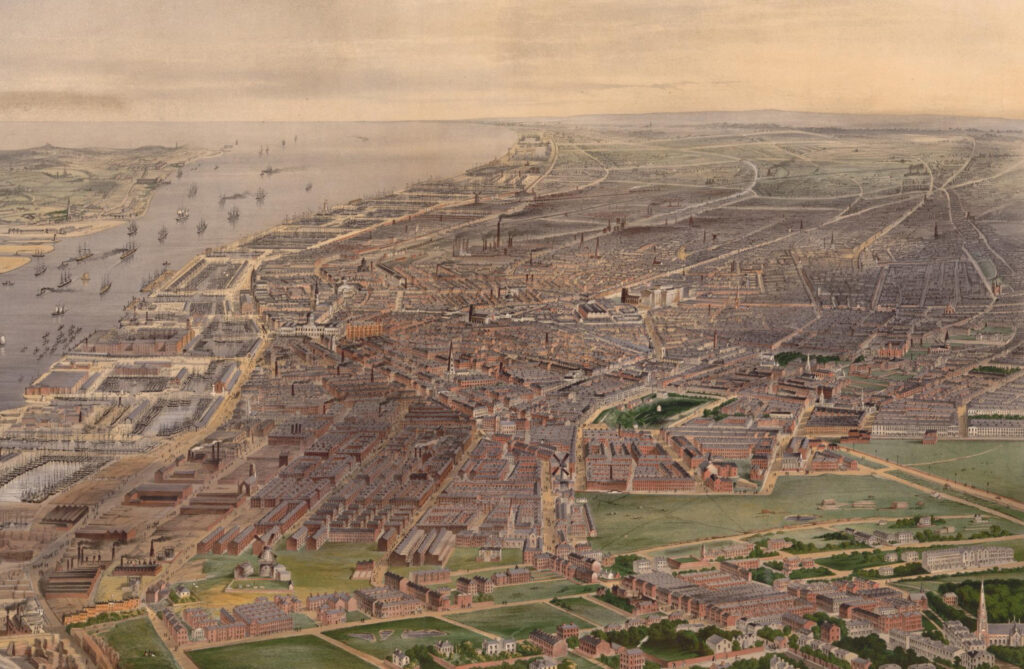
From 1864, almost 500 acres of parkland were created for public use, including Princes Park, Sefton Park, and Greenbank Park.
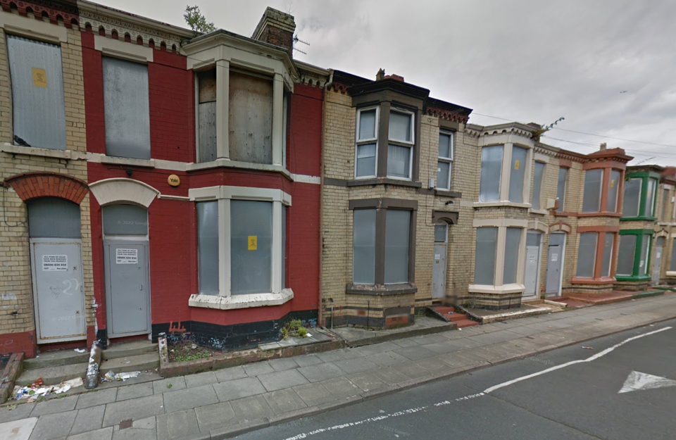
Toxteth was badly hit by economic stagnation and unemployment in the late 1970s, culminating in riots in July 1981, amongst the worst scenes of unrest seen during peacetime in Britain. Hundreds of people were injured and many buildings and vehicles were damaged. Although attempts have been made to regenerate the area and improve living standards, significant problems with unemployment and crime remain. Many Victorian properties in the area continue to lie derelict awaiting redevelopment.
Wavertree and Garston
Wavertree neighbours Toxteth to the east, and by the beginning of the 20th century the western half was essentially a continuation its terraced streets, while the remainder was still rural. This was gradually filled in with a combination of more terraces and some wider boulevards with semi-detached and detached houses for the middle-classes.
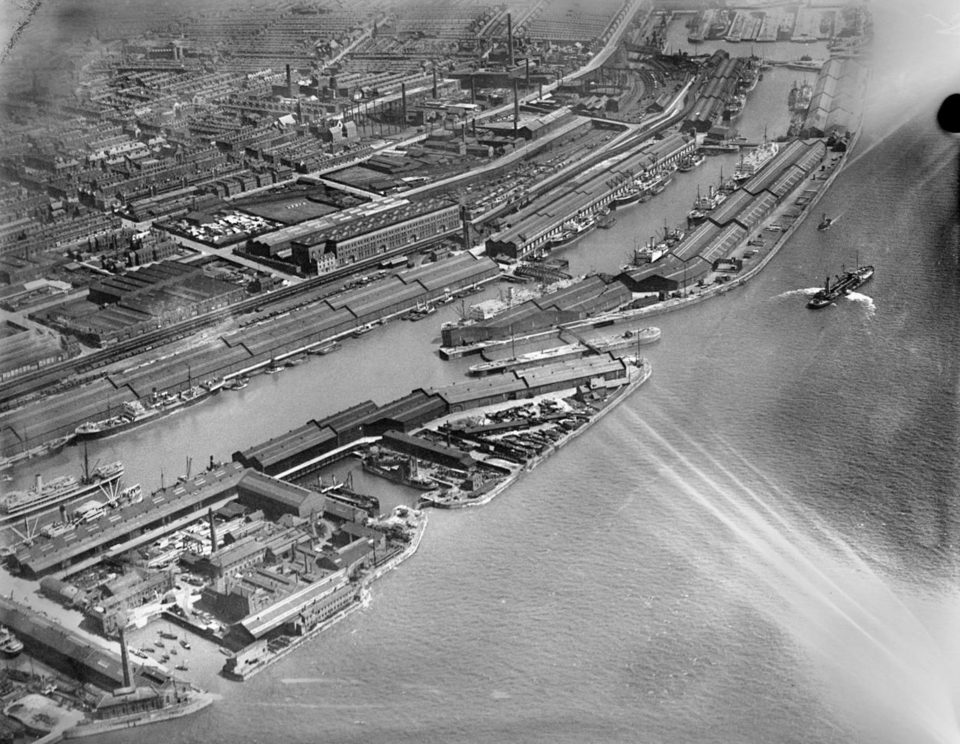
Garston, to the south of Toxteth, remained farmland until the mid-19th century when industrial expansion continued south. The first dock was constructed and opened in 1846, with the area becoming home to shipbuilding, graving docks, chemical works, distillers, matchmakers, brickworks, and sawmills. Brickmaking was particularly important, and Garston was perfectly placed to take advantage of the railway to easily export them inland. The population expanded as migrants flooded in to seek work, especially from Ireland. Like neighbouring Toxteth, the housing was cramped and of poor quality, but unlike there a series of redevelopment and regeneration schemes succeeded in reversing trends in dereliction and unemployment. Today, Garston is a major shipping and container port, with the Port of Garston second only to Liverpool Docks.
The new suburbs
As city centre slums were cleared and more housing was needed for the continuing influx of migrant workers, several new suburbs were built. Allerton and Woolton sit adjacent to Garston and were largely rural until they were transformed in the 1930s into semi-detached suburbia, with the latter in particular becoming home to the middle classes.
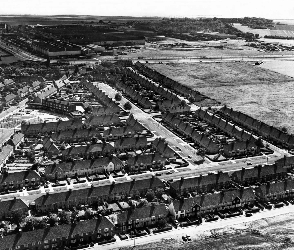
Speke lies along the Mersey to the south of Garston and Allerton and until the 1930s was a small village with a population of just a few hundred, known locally as the best wheat-growing land in the region. It was chosen as the site for Liverpool’s airport, constructed between 1930 and 1933, and then post-war as a complete self-contained satellite town. By the 1950s more than 25,000 people lived in newly built homes in one of the largest out-of-town council estates in the country. At the same time, the large expanses of flat land attracted industry, including motor works (Ford’s famous plant), light engineering, food, chemicals, and pharmaceuticals, while the airport was the second busiest in the UK. Unfortunately, Speke suffered a rapid decline in the mid-1970s and by 21st century was one of the most deprived areas in the country.
Further reading:

